|
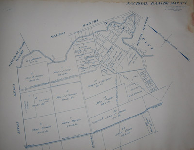
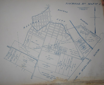
Salinas City 1917 Assessor's
Maps. These maps are part of Township of Monterey County
book discovered in the vault of the Salinas City Bank. They were
compiled in 1917 by the
Monterey County Surveyor and depict the division of lands from the
original Mexican Rancho
land grants.
Photographs courtesy of
Destination Salinas
HISTORIC SALINAS
RANCHO MAPS
These neat maps were discovered in the vault of the Salinas City Bank
& have been carefully preserved by the owner. 11" X 14" unframed.
- Reproductions of the 1917 Monterey County Surveyor Maps
- Original Mexican Rancho Land Grants & Divisions
- Printed on High-quality Archival Water Color Paper
- Matted & Framed using Gallery Quality Archival Materials
Pricing
| Description |
SKU # |
Price |
| One Map |
000010 |
$39.99 |
| Matted |
000011 |
$69.99 |
| Framed |
000012 |
$149.99 |
|